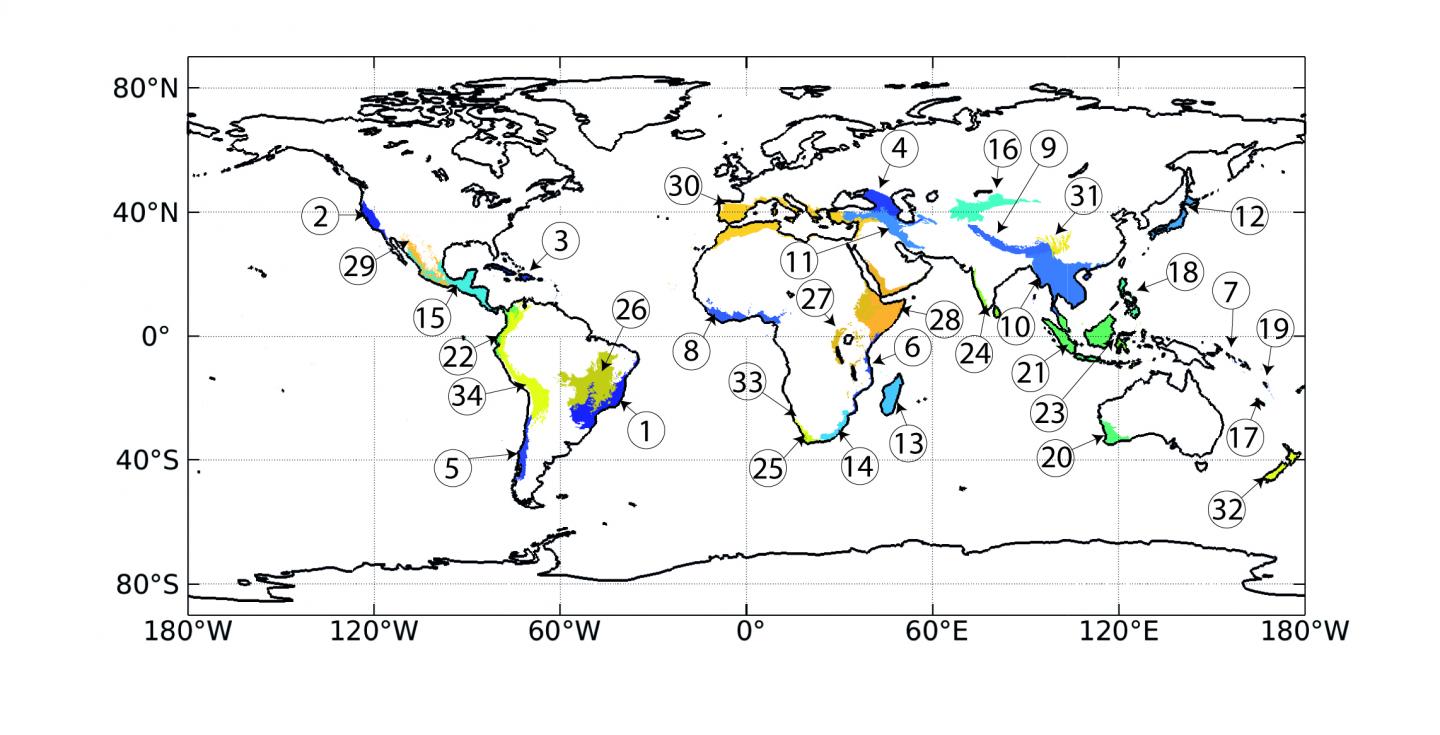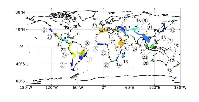
Photo: Biologists have identified 34 areas on the globe where biodiversity is both extremely high and at risk.
view more
Credit Image: Francesco Cherubini/NTNU
Between 1992 and 2015, the world’s most biologically diverse places lost an area more than three times the size of Sweden when the land was converted to other uses, mainly agriculture, or gobbled up by urban sprawl.
These losses all occurred in what are called “biodiversity hotspots”, or 34 areas scattered across the globe that contain “exceptional concentrations of endemic species that were undergoing exceptional loss of habitat,” according to the originators of the idea. To be considered a hotspot, an area must have already lost as much as 70 per cent of its primary vegetation and yet still remain home to least 1500 species of plants found nowhere else on Earth.
When the concept of a biological hotspot was first introduced in 2000, the idea was that governments and land managers could focus their conservation efforts on the areas, because protecting them would protect the greatest number of species in the most at-risk places.
Now, researchers from the Norwegian University of Science and Technology (NTNU) have found that even these high profile, extremely important areas are losing ground to agriculture and urban development. Their analysis is the first ever to look at all hotspots worldwide, and with a long time frame of nearly a quarter of a century.
“We see that not even focusing protection on a small range of areas worked well,” said Francesco Cherubini, the senior author on the paper. Cherubini is a professor at NTNU and director of the university’s Industrial Ecology Programme. “There was major deforestation even in areas that were supposed to be protected.”
The findings have just been published in Frontiers in Ecology and the Environment.
Cherubini and his colleagues from the Industrial Ecology Programme were able to document this trend by analysing high-resolution land-cover maps released by the European Space Agency. The maps present information on land cover worldwide from 1992-2015, or 24 years, at a resolution of 300 metres.
By integrating the maps with maps of the world’s biodiversity hotspots, the researchers were able to see how land cover in the hotspots changed over the period.
The researchers also wanted to see if protected areas inside hotspots fared better than areas outside of the protected areas, but still within the hotspots. For this, they determined which protected areas were inside hotspots based on the World Database on Protected Areas.
In both cases, the trends were not encouraging, said Xiangping Hu, the first author of the paper and a researcher at the Industrial Ecology Programme.
At least 148 million hectares in the hotspots — that’s 3.2 times the size of Sweden — were converted from the vegetation that was there in 1992 to some other use, the researchers found. Those losses over 24 years equated to a loss of 6 per cent of the total area of hotspots.
Most of these losses — nearly 40 per cent, or 54 million hectares — were in forests. Agriculture expansion gobbled up 38 million hectares of the areas that were once forests, Hu said.
The three top hotspots that lost the most forested area were in Sundaland (all of Indonesia), Indo-Burma and Mesoamerica.
The characteristic that links these three hotspots and makes them most susceptible to losing forests is that they are all in the tropics, Cherubini said.
“The soils in these areas are very fertile, and agricultural yields can be very high,” he said. “So it’s very productive land from an agricultural point of view, and attractive to farmers and local authorities who have to think about rising local incomes by feeding a growing population.”
While planting trees on agricultural land will help over the long term, it can’t make up for the losses of biodiversity over the short term.
Another issue is that the Earth’s rapidly growing population is boosting demand for agriculture products — and tropical areas are more at risk of being converted to fields and pastures because of socioeconomic and political factors, Cherubini said.
That, combined with weak environmental protection laws and regulations, explains why forests are being transformed into farms, he said.
“if you don’t have strong measures that can prevent conversion of key habitat to agricultural production, that’s where you have the expansion,” he said. “But those are also areas which are exposed to food insecurity.”
And although the planet’s booming population does put pressure on regions to increase food production, the reality is that most of the land is used to produce palm oil or soybeans for cattle feed, not feeding people directly. And growing crops to feed beef cattle doesn’t really benefit local populations in the long-term, Cherubini said.
“You have these big companies that are making these investments, with high risks of land overexploitation and environmental degradation” in producing cattle feed, he said. “The local population might get some benefits from revenues, but not much.”
The second question the researchers wanted to answer was if specific protected areas inside hotspots actually did what they were supposed to do.
Here again, the findings were somewhat discouraging. Even formally protected areas lost an equivalent of 5 per cent of their forest cover during the 24 years the researchers looked at.
The good news was that protected areas within hotspots generally lost less forest cover than the land outside protected areas, especially during the most recent period the researchers looked at, from 2010-2015.
The researchers also found that some hotspots gained forested areas, especially the mountains of Central Asia, the Irano-Anatolian area and the Atlantic forest in North America.
“Most of this increase in forests was due to reforestation of agricultural land. However, while planting trees on agricultural land will help over the long term, it can’t make up for the losses of biodiversity over the short term,” said Francesca Verones, another co-author who is also a professor at the Industrial Ecology Programme.
Cherubini and his colleagues say that the trends they have identified will only grow stronger as time goes on unless there is a concerted effort to reverse the losses.
There are things that people can do to reduce the pressure to convert lands, Cherubini said. Some of these actions were described in a special report from the Intergovernmental Panel on Climate Change, for which Cherubini was one of the lead authors.
“Increasing efficiency in agricultural production and the food value chain and distribution, cutting food waste and a change in diets to eat less meat can all help decrease pressure on land, which will make more space for conservation efforts and climate change mitigation,” he said.
Nevertheless, climate change has the potential to put pressure on lands, by requiring land for bioenergy crops or for tree plantations to soak up CO2, the researchers wrote.
And because many of these highly diverse areas are in poorer countries, biodiversity conservation won’t succeed unless the issues of poverty are addressed, Cherubini said
“We need to be able somehow to link protection to poverty alleviation, because most of the biodiversity hotspots are in underdeveloped countries and it’s difficult to go there and say to a farmer, ‘Well, you need to keep this forest — don’t have a rice paddy or a field to feed your family’,” he said. “We need to also make it possible for the local communities to benefit from protection measures. They need income, too.”
###
Reference: Overview of recent land-cover changes in biodiversity hotspots. Xingping Hu, Bo Huang, Francesca Verones, Otavio Cavalett and Francesco Cherubini. Frontiers in Ecology and the Environment 2020; doi:10.1002/fee.2276


