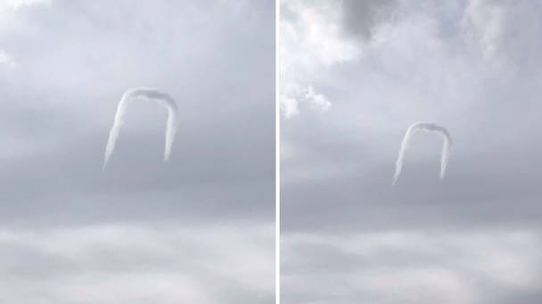
The horseshoe cloud is formed from a horizontal vortex, but Twitter was quick to believe there is some alien involvement in Nevada, US.
One of the rarest clouds ever. This was taken over Battle Mountain, Nevada, USA on 8 March 2018.
It's called a horseshoe cloud for obvious reasons. #nvwx
Credit goes to eagle-eye Christy Grimes. pic.twitter.com/XgQDY77ZzM
— NWS Elko (@NWSElko) March 9, 2018
These bent formations of condensation are caused when a flat cloud, usually originating as a small cumulus cloud, moves over a column of warm, rising air called a thermal. Sometimes, these clouds can form out of nowhere since air condenses as it rises into cooler air on the thermal.
Air rises the fastest where the column is warmest, so in this case, the middle of the cloud rises faster while the ends of the cloud don’t rise as fast. This is what gives the cloud the appearance of a horseshoe or a staple.
The different updraft speeds also give this cloud formation a bit of spin, which is why it is caused a vortex cloud. As the cloud rises, it often finds stronger winds at higher elevations and, thus, the top (or middle) of the cloud spins faster and allows it to pull up and away faster.
These clouds usually don’t last long, generally less than 20 minutes, and almost always form during the afternoon or evening hours when the sun has warmed the lower atmosphere enough to cause thermals.


